Take a grid question from source files to a network study
Work with documents, compatible network models, maps and study results beside the same grid-agent conversation.
The grid agent now has a workspace for questions that need both published grid evidence and files of your own. Open a full-page conversation, attach the material behind the question, and keep the maps, sources and outputs beside the answer as the investigation develops.
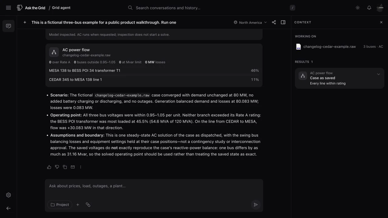
A compatible network case adds a numerical step to that investigation. Ask about the buses in the case, specify a change in injection, demand or branch status, and inspect the resulting study with its model and assumptions attached. The case, the live market and the question stay in the same conversation, while each result retains the inputs that produced it.
Read the file behind the question
Attach a document or network model to the conversation. Documents provide searchable passages on demand, and the file card keeps the original's identity and available page or row counts. Return to a sent file from the workspace's Files list when a follow-up needs its context.
The conversation can also use an authorized project model. Its file permissions still govern what the agent can read or use in a study.
Run a case with explicit assumptions
Compatible PSS/E RAW and RAWX cases support network inspection and numerical studies. Lossless DC power flow screens changes in injections, withdrawals, load and branch outages. Supported full AC power flow adds bus voltage, reactive power, losses and MVA loading for the supplied steady-state case.
A study card identifies the model, scenario, solve count and expected outputs. Larger plans show their steps before execution and can continue in the background. Completed results retain their assumptions and residual checks; unsupported electrical features remain identified with the case. These case calculations do not establish interconnection approval or system stability.
Keep the results beside the answer
The context panel collects study plans, progress, completed results and failures with the files and sources used by the conversation. Reopen a thread to return to those outputs and ask about the same scenario.
Geographic explanations can include annotated maps, and other questions can produce interactive visualizations with their sources, units and hypothetical inputs. Expand an output for a closer look or take it with you, then continue the investigation from the evidence already assembled.