BPA brings the Northwest hydro system into the workspace
Bonneville now has its own map, operating desks, hydro-project readings, and transmission evidence alongside the seven organized US markets.
Start with Bonneville’s balancing area and follow the operating picture from demand and generation to the dams and transmission paths behind it. BPA now has a dedicated map and Radar workspace, bringing the Northwest hydro system into the same research flow as ERCOT, CAISO, NYISO, PJM, MISO, SPP, and ISO-NE.
The workspace keeps the region’s sources in view. BPA publishes balancing-area operations and transmission information; USACE supplies project-level water readings; CAISO publishes the WEIM prices at Bonneville locations. Their units, coverage, and update times travel with the readings, so a five-minute price and a daily transmission workbook can be interpreted on their own terms.
A balancing area on the map
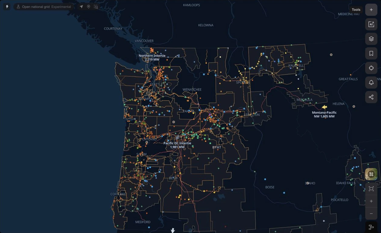
Choose BPA from the balancing-area section of the grid switcher. Its map brings together utility territories, regional transmission and substations, generation, river gauges, and operator events. Named interties put the Northwest’s connections to neighbouring systems into geographic context.
BPA is a balancing authority. WEIM price locations retain CAISO as their publisher, while BPA’s own load, generation, and transmission feeds describe its operating footprint. That distinction remains visible as you move between a map selection, its source, and the agent.
An operating desk built around hydro
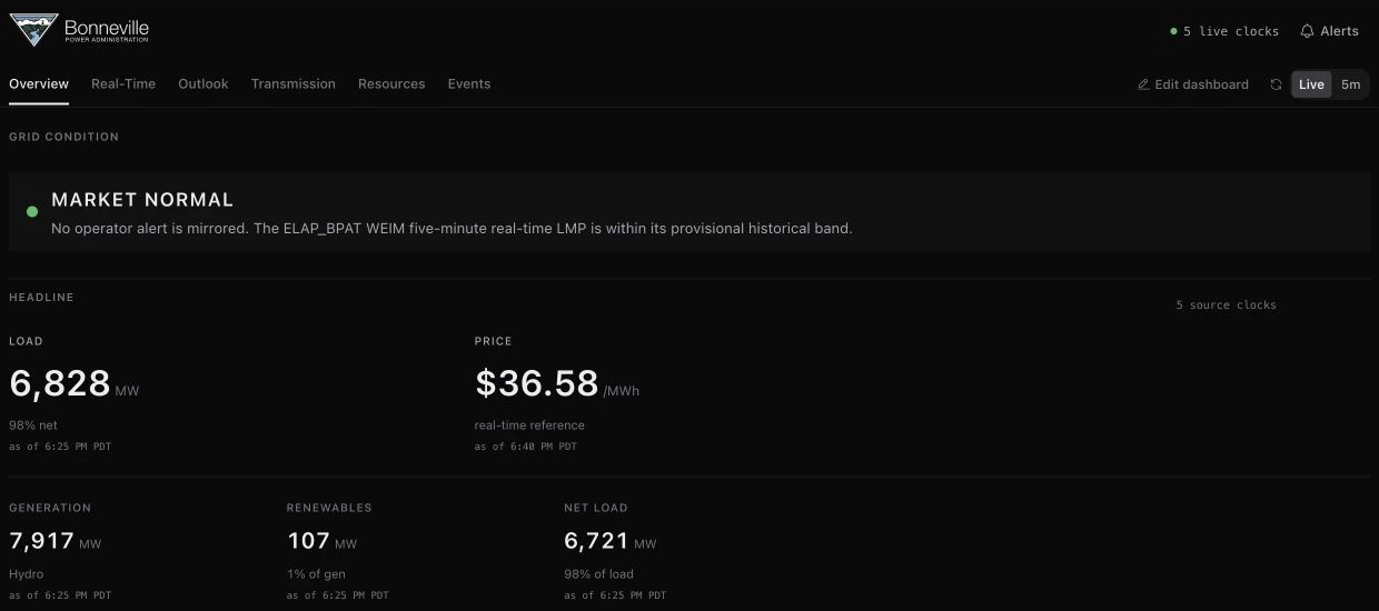
Radar opens with demand, a real-time price reference, generation, renewables, and net load. Supply and demand charts sit beside the generation mix, allowing a reader to see how the current balance is being met and when each source last updated.
Use the Transmission and Events desks to continue into published transfer interfaces and scheduled outages. The event record carries the affected facility and the operator’s reported status, linking the broad operating read to a named piece of infrastructure.
Follow the water through named projects
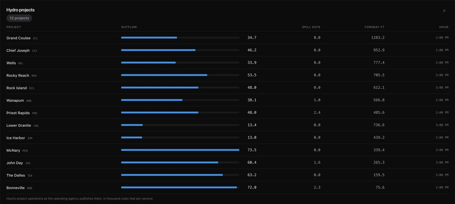
The Hydro projects panel gathers outflow, spill, forebay elevation, and the reporting hour for named projects along the Columbia and Snake Rivers. Expand it to compare Grand Coulee, Chief Joseph, McNary, Bonneville, and the other available projects in one table.
Outflow and spill are reported in thousand cubic feet per second; forebay elevation is in feet. These are project-operation readings from the publishing agency. Their timestamps let you compare the hydro system without treating every row as a simultaneous sample.