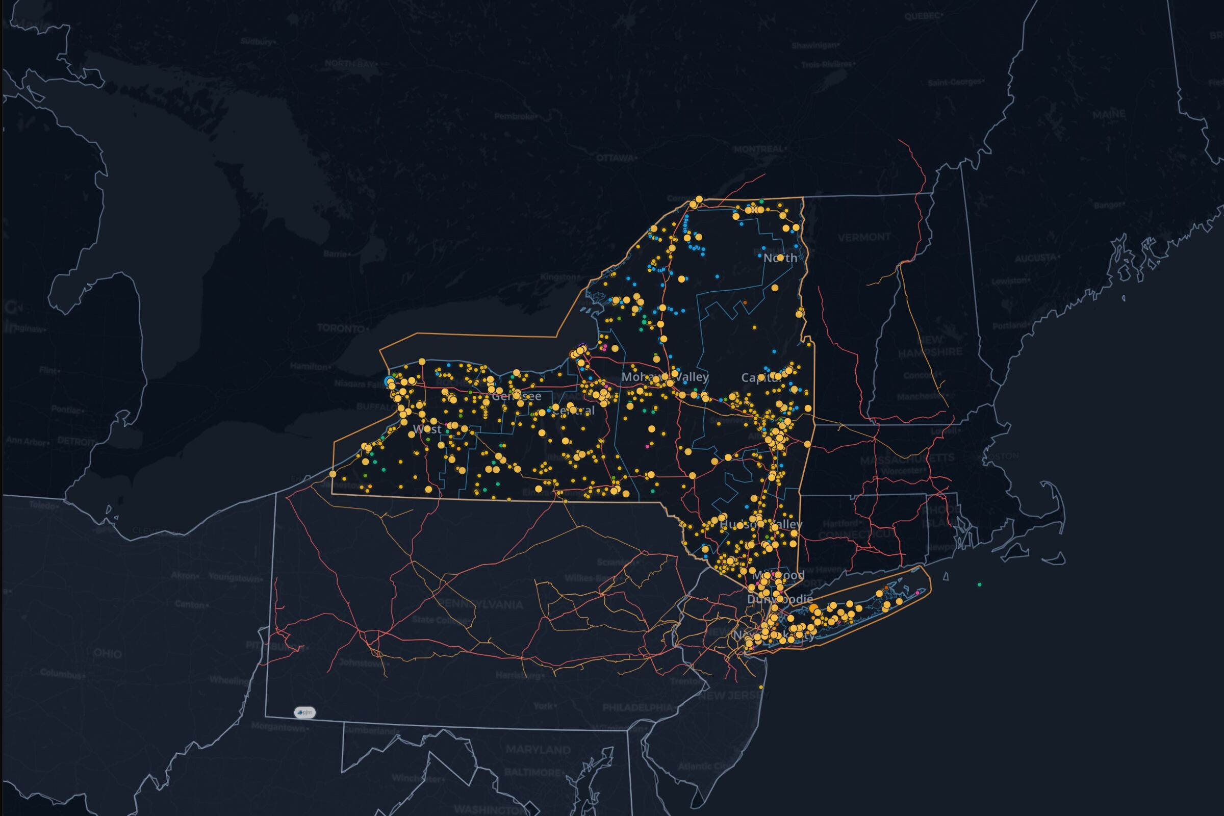
NYISO transmission map: lines, substations and zones
Public HIFLD transmission lines and substations across New York, shown with NYISO's eleven load zones. Orient an asset, county, or development area against the network geography, then open the same layers on the live map.
NYISO transmission map: lines, substations and zones
Public HIFLD transmission lines and substations across New York, shown with NYISO's eleven load zones. Orient an asset, county, or development area against the network geography, then open the same layers on the live map.
The transmission-line and substation features available in the Homeland Infrastructure Foundation-Level Data (HIFLD) public inventory, placed beside NYISO market zones on Ask the Grid's interactive map.
How to use it
New York's transmission picture splits between generation-heavy upstate corridors and the constrained import paths feeding New York City and Long Island. Read the public line and substation geography against the zone boundaries to see which side of that split a site sits on, then take the electrical questions — available capability, constraints, feasibility — to the NYISO and utility study process.
Questions
What does this map show?
The transmission lines and substations published in the HIFLD public inventory, drawn across NYISO's load zones. It is geographic reference data — the operational network model, line flows, and available transfer capability stay with NYISO.
Can I tell from the map where an asset can interconnect?
It shows you where the public network geography runs, which is the starting point. Whether a specific point of interconnection works is settled by the applicable utility's and NYISO's study process.
Can I inspect the source dataset?
Yes. The Ask the Grid catalog page documents the HIFLD transmission-line dataset, source, schema, and available coverage.
Real-time dispatch reports Goudey–Laurel L 115 kV circuit 1 with a −$1,000/MWh shadow price under contingency E.TOWANDA-HILLSIDE_230_70&PAR, in the top 5% of what NYISO pays to hold a constraint; the largest of 3 current constraints. It bound on 3 of the previous 30 days.
Real-time dispatch reports Chemung–Nwaverly 115 kV circuit 1 with a $550/MWh shadow price under contingency SCB:WATRCURE(69/2B42)69&BK2, in the top 5% of what NYISO pays to hold a constraint; the largest of 3 current constraints. It bound on 12 of the previous 30 days.
WEST to DUNWOD spans $127/MWh while Goethals–Linden 230 kV circuit 1 carries a −$4,000/MWh shadow price. It has gone unheld for 5 minutes and bound on 14 of the previous 30 days.
Real-time dispatch could not keep Goethals–Linden 230 kV circuit 1 within its limit under contingency SCB:RAMAPO(T1500-W72):W72&5018, so its −$4,000/MWh shadow price is NYISO's transmission demand curve rather than the cost of any resource. It has gone unheld for 5 minutes and bound on 14 of the previous 30 days.
Real-time dispatch reports Hillside–E.TWANDA 230 kV circuit 1 with a −$1,000/MWh shadow price under contingency SHICKSHI-SUSQUEHA_500_5067, in the top 5% of what NYISO pays to hold a constraint. It bound on 9 of the previous 30 days.