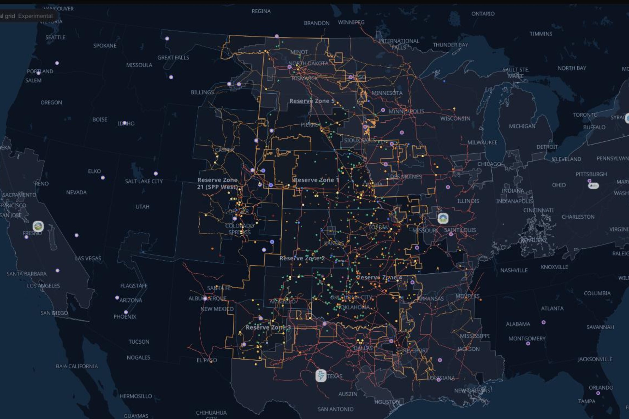
Where does the public transmission inventory sit across SPP?
Public HIFLD transmission lines and substations across the Southwest Power Pool, from the Dakotas to the Texas Panhandle. Orient a wind site, load, or development area against the network geography, then open the same layers on the live map.
Loading the latest grid view…
Where does the public transmission inventory sit across SPP?
Public HIFLD transmission lines and substations across the Southwest Power Pool, from the Dakotas to the Texas Panhandle. Orient a wind site, load, or development area against the network geography, then open the same layers on the live map.
The transmission-line and substation features in the HIFLD public inventory, shown across the SPP footprint with the same layers available in Ask the Grid's live map.
How to use it
SPP's wind resource is concentrated in the west of the footprint and much of its load is further east, so the corridors between them shape where new generation can connect. Read the public line and substation geography against a site, then take ratings, constraints, and available capability to SPP's planning and interconnection studies.
What people ask
What does this map show?
The transmission lines and substations published in the HIFLD public inventory, drawn across the SPP footprint. It is geographic reference data — the operational network model, line ratings, and real-time flows stay with SPP and the transmission owners.
Can I tell from the map where a project can interconnect?
It shows where the public network geography runs, which is the starting point. Whether a specific point of interconnection works is settled by SPP's interconnection studies and the transmission owner.
Can I inspect the underlying public data?
Yes. The linked Ask the Grid catalog page documents the HIFLD transmission-line source, schema, and coverage.
Does “Open network map” restore this exact view?
Yes. It opens the live SPP workspace with the same transmission, substation, and zone layers and the same viewport shown on this page.