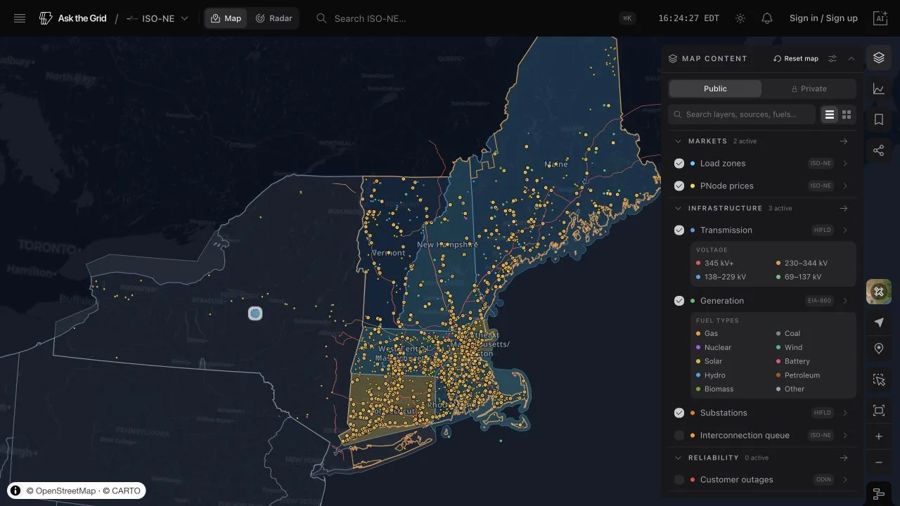
Where is ISO New England's interconnection queue asking to connect?
ISO New England's published generation and storage requests, with records placed at county level only when the source supports an unambiguous match — then open the same sourced view on the map.
Where is ISO New England's interconnection queue asking to connect?
ISO New England's published generation and storage requests, with records placed at county level only when the source supports an unambiguous match — then open the same sourced view on the map.
This is Ask the Grid's mirror of ISO New England's official Interconnection Request Tracking Tool publication. It preserves requested capacity, technology, queue identity, and operator status. The map plots only records whose county or utility location resolves unambiguously; unresolved rows remain in the source-backed table rather than being assigned invented geography. ISO-NE's current feed does not supply a dependable proposed-completion-date field.
Why it matters
The queue shows where developers have requested grid access for offshore wind, storage, solar, gas, and other projects. Reading the resolved records by county and technology helps locate concentrations of requested capacity without treating missing geography as zero or a queue request as a built project.
Questions
Is requested MW the same as operating capacity?
No. Queue capacity is the amount a project has requested to interconnect. It is not installed, operating, or likely-to-complete capacity, and it does not establish available transmission headroom.
Where does this data come from?
ISO New England's official Interconnection Request Tracking Tool (IRTT). Ask the Grid mirrors each publication and stamps when the operator published it, so every row is attributable to a specific ISO-NE release.
How precise is the project location shown?
The public queue does not publish exact project geometry. Ask the Grid plots only projects with an unambiguous county or utility match at county level; records that cannot be resolved remain unplaced. A named point of interconnection is location evidence, not exact geometry or a feasibility measurement.
1200 MW non-controllable ETU - N to S flow only1227
Somerset/Aroostook
other
1,200 MW
—
Feb 16, 2022
Oct 8, 2026
1200 MW non-controllable ETU - N to S flow only1228
Hancock/Aroostook
other
1,200 MW
—
Feb 16, 2022
Oct 8, 2026
1200 MW non-controllable ETU - N to S flow only1230
Somerset/Aroostook
other
1,200 MW
—
Mar 4, 2022
Oct 1, 2027
1200 MW non-controllable ETU - N to S flow only1236
Aroostook/Somerset
other
1,200 MW
—
Mar 21, 2022
Jun 1, 2028
Offshore Wind1297
NA
wind
1,200 MW
—
Aug 15, 2022
Jan 31, 2029
non-controllable objective ETU to enable 1200 MW injection near Millstone substation1309
New London
other
1,200 MW
FS:Document Posted/SIS:Not Started
Sep 23, 2022
May 1, 2029
Enable 1200 MW injection at Mystic1332
—
other
1,200 MW
FS:Document Posted/SIS:Not Started
Nov 8, 2022
May 1, 2029
Offshore Wind1343
NA
wind
1,200 MW
FS:Document Posted
Dec 19, 2022
Jul 15, 2029
1200 MW Controllable ETU1350
—
other
1,200 MW
—
Jan 31, 2023
Sep 1, 2029
1200 MW non-controllable ETU - N to S flow only1370
Aroostook/Somerset
other
1,200 MW
—
Mar 15, 2023
Jun 1, 2028
Showing the top 100 of 1,617 queue entries by requested capacity. Open the live map for the full, filterable view.
Does “Open in Map” restore this exact view?
Yes. It carries the same layers, filters, viewport, and timeline state shown on this page into the live ISO-NE workspace — the same save/restore system behind a personal saved view.
The underlying table, its schema, and its history.